With the help of laser imaging and a water-current detecting buoy, specialists from the National Oceanic and Atmospheric Administration (NOAA) aided the rescue, recovery, and cleanup efforts after the fatal Jan. 29 midair crash of an airliner and Army helicopter over the Potomac River.
The NOAA team assisted federal and local government officials in mapping the wreckage and ensuring the river was safe to navigate. NOAA brought in a team of experts from various fields to help smooth the effort.
The National Transportation Safety Board (NTSB) led the recovery effort and investigation. Preliminary findings suggest that the helicopter may have been operating at an incorrect elevation, according to the NTSB.
“The Black Hawk was at 300' on the air traffic control display at the time of the collision,” NTSB officials said in an investigation update.
While the wreckage was recovered by Feb. 11, the investigation of the crash is still ongoing and could take some time to conclude.
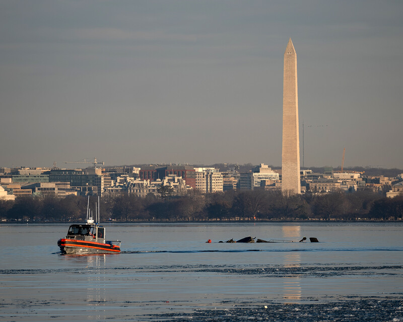
The crash of the American Airlines Bombardier CRJ700 passenger jet and a U.S. Army Sikorsky UH-60 Black Hawk helicopter happened near the Ronald Reagan Washington National Airport, killing all 67 passengers and crew traveling in the plane and helicopter. NOAA’s National Ocean Service sent teams to help with recovery and response efforts. Due to freezing cold waters, and substantial debris in the water, the response and recovery effort was challenging, NOAA officials said.
NOAA worked with the U.S. Coast Guard, NTSB, U.S. Army Corps of Engineers, and other local and federal officials in search and recovery, wreckage removal, and ensuring safe navigation. Experts from across NOAA provided valuable data and mapping to guide divers, aid salvage crews, and keep response teams informed in challenging conditions.

“NOAA’s nautical navigation products and services are critical for a safe, secure, and prosperous economy,” said NOAA representative Jasmin S. Paquet-Durand Ford. But without nautical charts and the precise tide and weather data NOAA provides, “maritime commerce fails,” he added. “For most U.S. industries, 50% or more of their international trade in goods travels through maritime supply chains.”
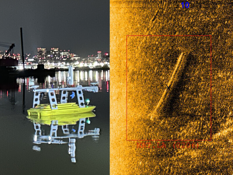
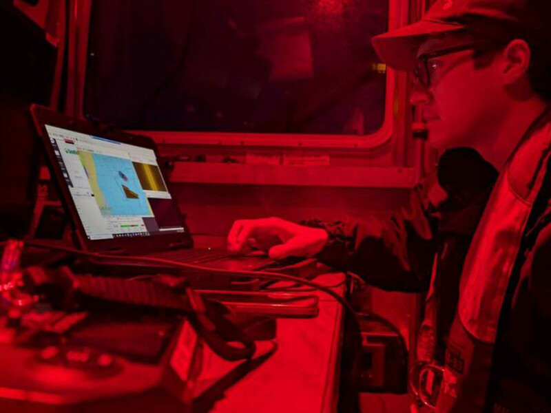
Within hours after the call from the U.S. Coast Guard and D.C. Fire, NOAA’s Patuxent Navigation Response Team was at the crash site. The NOAA survey team used multibeam and side-scan sonar technology to map the underwater debris field.

The NOAA team included civilian hydrographers and NOAA Corps officers and worked with local and federal agencies to survey the river’s main channel and the debris field. Using this data, NOAA provided a detailed sonar map of the wreckage to a graphic information system dashboard. The survey identified more than 50 possible targets for divers, leading them to key wreckage.
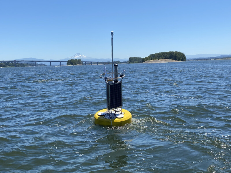
NOAA also deployed a current and meteorological buoy (CURBY), which provided responders with critical information on water movements and conditions and enhanced crew safety and effectiveness.
While debris in the water posed risks, NOAA’s sonar surveys helped identify hazards and guide emergency teams in clearing the waterway by pinpointing obstructions that needed to be removed for safe travel. NOAA also responded to a request to conduct LiDAR (light detection and ranging) flights over the crash site and used a Twin Otter aircraft piloted by NOAA Corps officers to do so.
“Unfortunately, the LiDAR flight did not result in any usable imagery. We supported the recovery efforts mainly via NOAA navigation response teams, which are vessels on the water — in this case, one small boat and two uncrewed survey vessels, or autonomous survey vehicles,” said Ford. “Once NOAA arrived on-scene, virtually all survey operations, particularly in the shallow water debris field, was turned over to NOAA field units (navigation response teams). Our work fueled all salvage and dive operations for the remainder of the response, which included the support of weather and current operations provided by NOAA to support dive and on-the-water operations of salvage.”
NOAA’s Mid-Atlantic Navigation Manager was embedded at the Unified Command Center, and experts from the Office of Coast Survey, the Center for Operational Oceanographic Products and Services, and the National Geodetic Survey also helped in locating and recovering wreckage, supporting search and salvage efforts, and ensuring safe navigation. Aircraft and vessels operated by NOAA’s Commissioned Officer Corps were also tasked with supporting operations. In addition to these efforts, the Office of Response and Restoration provided marine pollution and trajectory forecast support.
Most likely do not recall the last time two aircraft collided and destroyed each other and all life aboard over a body of water. Such an incident is quite rare. Some in the aviation community called the accident essentially a freak accident — basically rarer than a lightning striking someone on a walk.
“Midair collisions, while tragic, are extremely rare, thanks to the extensive safety protocols, air traffic control systems, and the professionalism of pilots and aviation personnel worldwide. The aviation industry continuously strives to improve safety through advancements in technology, training, and regulations. While any loss of life is devastating, it’s important to recognize the many layers of safeguards in place that make such incidents incredibly infrequent,” said John Werner, CEO, Pilot John International. “Our hearts go out to the families affected by this tragedy, and we remain committed to supporting the industry in further enhancing safety standards.”

NOAA’s Center for Operational Oceanographic Products and Services (CO-OPS) presently maintains and operates multiple six current real-time buoys, or CURBYs, said Ford. NOAA’s Office of Response and Restoration maintains an additional two CURBYs.
The CURBY made its first operational debut for CO-OPS in 2019 when it was deployed near Philadelphia in support of NOAA’s Delaware Bay and River tidal currents survey.
CURBYs have since been deployed along the Pacific, Atlantic, and Gulf coasts in support of scientific research, disaster recovery, and navigational safety.


